The Growing Need for Real-Time Visibility in Large-Scale Plantation Operations
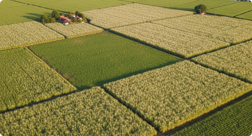
Large-scale plantation environments present a unique set of operational challenges. Estates often span thousands of hectares, with diverse terrain, limited accessibility, and multiple risk factors occurring simultaneously. Managing such environments requires continuous monitoring of fire risks, unauthorized access, infrastructure conditions, and field activities.
Traditional monitoring approaches rely heavily on manual patrols, guard posts, and limited fixed surveillance systems. While these methods provide basic oversight, they are often insufficient in delivering real-time visibility across large operational areas. Delayed detection of incidents, inconsistent coverage, and high manpower requirements reduce overall effectiveness.
As operational scale increases, plantation managers require systems that enable faster detection, broader visibility, and more proactive risk management. Aerial surveillance using unmanned aerial systems provides a scalable and efficient solution to address these needs.
Limitations of Conventional Monitoring Methods
Manual and ground-based monitoring approaches face several structural limitations:
Coverage is restricted by terrain and accessibility
Patrol frequency depends on manpower availability
Response times are often delayed due to distance
Monitoring quality varies between operators
Critical events may go undetected in remote areas
Fire detection is one of the most critical gaps. Early-stage heat buildup or smoldering zones may not be visible from the ground, allowing incidents to escalate before action can be taken. Similarly, unauthorized activities such as encroachment or asset misuse can occur in areas that are not regularly monitored.
These limitations create a need for systems that can provide consistent, repeatable, and wide-area monitoring without being constrained by ground conditions.
Aerial Surveillance as a Modern Monitoring Approach
Drone-based surveillance systems provide an aerial perspective that significantly improves situational awareness. By operating above the plantation canopy, these systems can cover large areas quickly while capturing high-resolution visual and thermal data.
Aerial surveillance enables:
Rapid area assessment without physical access constraints
Detection of anomalies across large operational zones
Real-time monitoring through live data transmission
Repeatable patrol routes using automated flight planning
Flexible deployment for both routine and incident-based monitoring
This approach transforms surveillance from a reactive activity into a proactive and data-driven process.
Operational Workflow of Drone-Based Surveillance
Effective aerial surveillance operations follow a structured workflow to ensure consistency and reliability:
Area Mapping and Risk Segmentation
Plantation areas are mapped and categorized based on risk factors. High-risk zones may include fire-prone regions, boundary lines, storage areas, and infrastructure corridors.
Flight Planning and Scheduling
Operators define waypoint-based patrol routes tailored to each zone. Flights can be scheduled at regular intervals or deployed on-demand based on operational requirements.
Autonomous Flight Execution
The drone follows predefined routes, capturing visual and thermal data. Flight parameters such as altitude and speed are optimized to balance coverage and image clarity.
Real-Time Monitoring
Live video feeds allow operators to monitor field conditions and identify anomalies, including heat signatures, smoke, or unusual activity.
Data Logging and Analysis
All flight data is recorded, enabling post-flight review, reporting, and continuous improvement of monitoring strategies.
Technical Capabilities of Surveillance Drone Systems
Aerial surveillance in plantation environments typically combines two categories of drone platforms: long-range fixed-wing systems for wide-area coverage and multi-rotor systems for close to medium-range inspection.
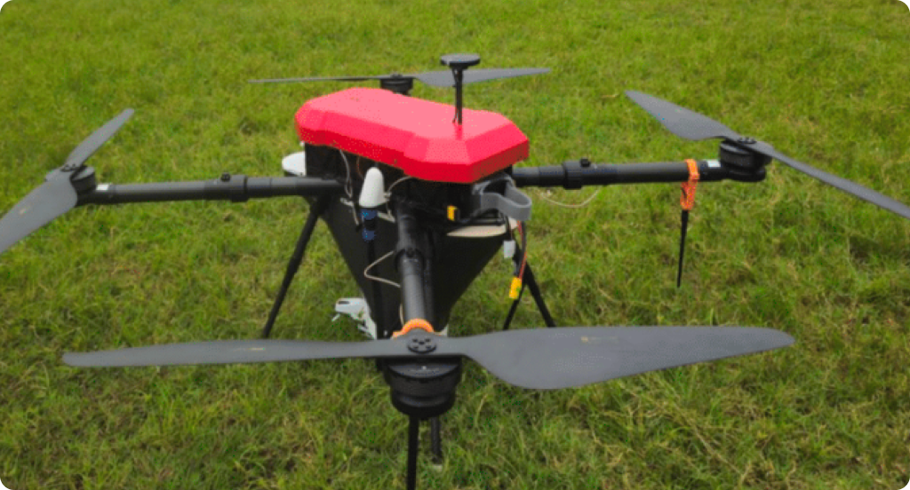
Long-Range Surveillance Platforms (V3 / V3S)
Long-endurance platforms such as the V3 and V3S are designed for large-scale monitoring across extensive plantation landscapes.
Flight time up to 240 minutes
Control range up to 30 km
Coverage distance up to 280 km per mission
Cruise speed of 18–20 m/s
Payload options including high-resolution RGB cameras, thermal sensors, and laser range finder (optional)
Optional RTK/PPK support for improved positional accuracy
These platforms are used for routine patrols, fire monitoring, and boundary surveillance across multi-estate, wide operational areas.
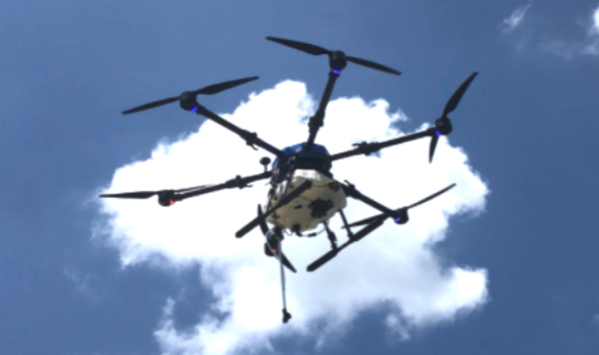
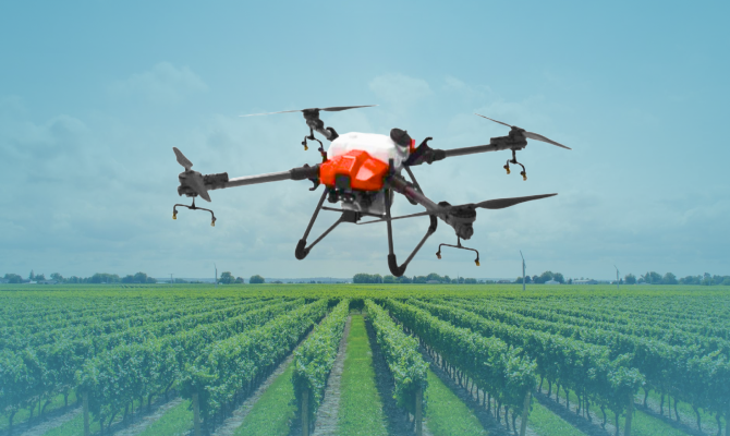
Close to Medium-Range Inspection Platforms (M120 / S120)
Multi-rotor platforms such as the M120 and its surveillance variant S120 are designed for detailed inspection and localized monitoring.
Flight time up to 90 minutes
Operational speed of 8–12 m/s
Telemetry range up to 20 km
Payload capacity up to 5 kg
High-resolution RGB camera with up to 40x optical zoom
Thermal imaging sensor for heat detection
Laser range finder for precise distance measurement (optional)
3-axis stabilized gimbal with 360-degree coverage
AI-assisted tracking and object detection
These platforms are used for incident verification, detailed inspections, and monitoring of specific areas requiring higher resolution and precision within-estate.
Key Monitoring Applications
Drone-based surveillance systems support a wide range of operational monitoring activities:
Fire Detection and Prevention
Thermal imaging enables early detection of abnormal heat signatures before visible flames appear. This allows for faster response and reduces the risk of large-scale fire incidents.
Perimeter and Boundary Monitoring
Regular aerial patrols help detect unauthorized access, theft, or damage to boundary infrastructure, improving overall estate security.
Asset Monitoring and Protection
Drones can monitor machinery, vehicles, and storage facilities, enabling quick verification of asset conditions and detection of unusual activity.
Remote Area Surveillance
In areas with limited accessibility, aerial systems provide an efficient alternative to ground patrols, ensuring consistent monitoring coverage.
Improving Response Time and Coordination
One of the most significant advantages of aerial surveillance is the ability to reduce response time. With real-time visibility and precise geolocation data, operational teams can:
Identify risks earlier
Locate incidents accurately
Dispatch response teams efficiently
Verify field conditions without delay
For example, when a thermal anomaly is detected, operators can immediately pinpoint its location and coordinate a response, reducing both time and resource expenditure.
Enhancing Theft Deterrence and Security
The presence of aerial surveillance systems also acts as a deterrent against theft and unauthorized activities. Regular drone patrols increase monitoring visibility and reduce opportunities for illegal actions.
Consistent surveillance coverage minimizes blind spots and ensures that all areas of the plantation are monitored regularly. This strengthens overall operational control and security.
Long-Term Operational Benefits
The adoption of drone-based surveillance systems provides several long-term advantages:
Improved early detection of operational risks
Reduced dependency on manual patrols
Enhanced visibility across large areas
Faster response and better coordination
Scalable monitoring capabilities adaptable to plantation size
By integrating aerial intelligence into daily operations, plantation managers can improve resilience and maintain greater control over their environments.
Conclusion: Advancing Risk Intelligence Through Aerial Systems
Aerial surveillance systems represent a significant advancement in plantation monitoring and risk management. By combining long-range coverage with close to medium-range inspection capabilities, these systems provide a comprehensive approach to operational intelligence.
Through real-time visibility, advanced imaging technologies, and automated workflows, plantation operators can move from reactive monitoring to proactive risk management. As operational demands continue to grow, aerial surveillance will play an increasingly important role in ensuring safety, efficiency, and long-term sustainability.
Related blog posts